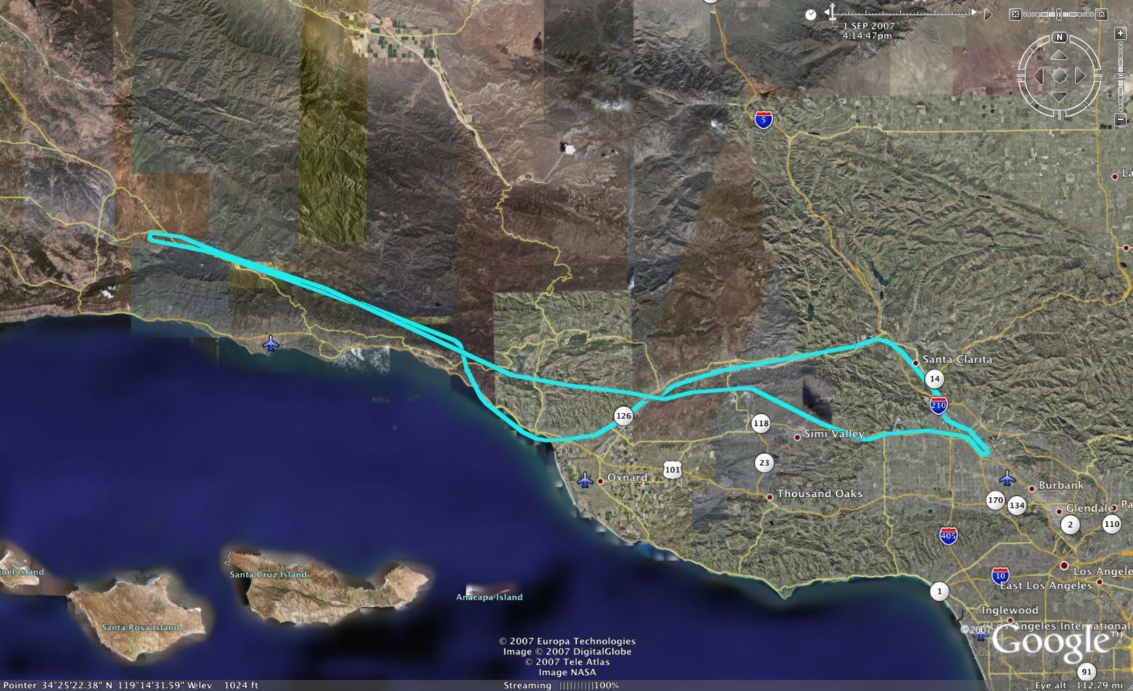
Long Cross-Country to Santa Ynez
Aircraft:Cessna 172L – N19688
Length of Flight: 2.3 Hrs – Solo
Total Flight Hours to Date: 49.9 Hrs
Altitude: 5500-6500 Feet
Route: Whiteman to Santa Ynez
Cost: $238.15
![]() Click to download the Google Earth flight path. (Google Earth Help)
Click to download the Google Earth flight path. (Google Earth Help)
Here’s the video!
Read more to see the video!
So this was the day to do my long cross-country. That’s where the rountrip mileage has to be at least 150 miles, on leg of the journey has to be 50 miles and you have to make full stop landings at 3 different airports. I spent a few hours the night before planning this cool trip to Boreggo Valley airport (out near Palm Springs). Then these storms started moving in and by the time I was set to leave it was hailing at Boreggo Valley, it was 110 degrees at Palm Springs and hail just down the road a piece.
So that was out. I decided to go back towards my old friend the coast! I quickly planned a trip to Santa Ynez, stopping (landing) at Santa Paula on the way back. Took a couple hours to get all the navigation down, what compass heading, factoring in the wind, what airspeed, what altitude, how much gas…etc. It’s actually fine, because now I’m totally good at doing those navigation log sheets.
I’ve been trying to figure out a way to record what I hear in my headset in the airplane, including me talking (that’ll be good) I went out and got all the adapter cables and such and tested it on my handheld aviation radio and it seemed to work great. But when I hooked it up inside the airplane it wasn’t working properly so I yanked it and moved on. More research on that one. I didn’t shoot as much on this trip as I would have liked. I was a little busy, but managed to get of a few minutes of video. It’s mostly over the Fillmore area, just after I took off from Santa Paula heading back to Whiteman.